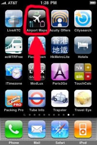
iPhone ‘App’ Of The Week : Airport Maps
Web: www.stevenfrischling.com — E-Mail: fish@flyingwithfish.com
23/07/2009 – iPhone ‘App’ Of The Week : Airport Maps
Knowing where you’re going in the airport always makes life on the road, stuck in the airport, easier and more enjoyable. In new airports or known airports there are often things to explore…especially in larger airports. While I have written about airport gate map Apps before, this week’s iPhone App of the Week is a bit different.
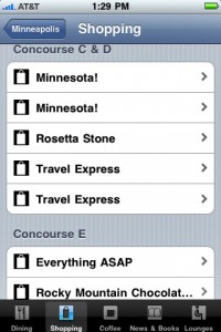
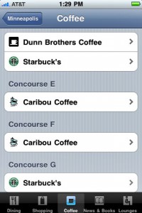
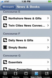
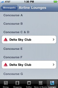
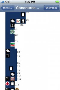
This weeks’ iPhone App of the Week, Airport Maps, offers users not only diagrams of airports and terminals, but also a detailed view of restaurants, shops and airline lounges.
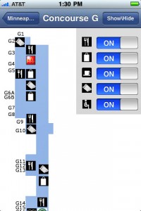
The icons used by Airport Maps are simple, knife & fork for food; coffee cup for coffee/snack spots; shopping bags for stores; book for book stores; ‘DFS’ for duty free; sunglasses for sunglasses; wrapping paper for gift shops; twisted pretzels for pretzel stands, etc etc etc. Some larger brand shops display the logo of the company, such as McDonalds, The Gap, Starbucks and The Body Shop. Additionally airline lounges are identified with the logo of the airline.
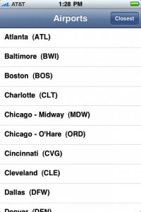
While Airport Maps is currently only available for slightly over 35 airports in the United States (and Toronto Pearson/YYZ), I found this App to be a very useful resource when quickly transiting airports and searching for food or lounges. The list of available airports appears to be is growing every few weeks, which is fantastic!
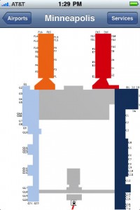
Using the App is simple. Click on the airport you’re interested in, click on the terminal you want, then scroll around or expand the view. To view the shops by name click on an icon and the name of the shop appears. The names of each shop appear by clicking on them even when in airplane safe mode, which means you don’t need a mobile signal or wifi for the Airport Maps App to be fully functional. To make searching easier some larger terminals, such as San Francisco International Airport’s (SFO) Terminal 1 are broke up into two different maps, although it is very easy to determine where you are clicking by looking at the overall airport map.
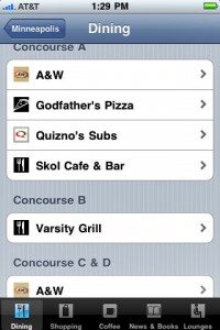
Want to quickly find a shop or restaurant without searching in each terminal? From the main airport map page click on “Services” in the upper right hand corner and a drop down menu listing each shop, sorted by terminal, is available in alphabetical order. The services are broken down by Dining, Shopping, Coffee, News & Books and Lounges to make searching more user friendly.
As of today, Airport Maps is available for these major airport hubs that you probably travel through on your way from Point A-to-Point B:
Atlanta (ATL); Baltimore (BWI); Boston (BOS); Charlotte (CLT); Chicago Midway (MDW); Chicago O’Hare (ORD); Cincinnati (CVG); Cleveland (CLE); Dallas-Ft Worth (DFW); Denver (DEN); Detroit (DTW); Ft. Lauderdale (FLL); Honolulu (HNL); Houston (IAH); Kansas City (MCI); Las Vegas (LAS); Memphis (MEM); Miami (MIA); Minneapolis (MSP); New York/JFK (JFK); New York LaGuardia (LGA); Newark (EWR); Orlando (MCO); Philadelphia (PHL); Phoenix (PHX); Pittsburgh (PIT); Portland (PDX); Raleigh-Durham (RDU); Salt Lake City (SLC); San Diego (SAN); San Francisco (SFO); San Jose (SJC); Seattle (SEA); Toronto (YYZ); Washington DC Dulles (IAD); Washington DC Reagan (DCA)
Hopefully Airport Maps will expand internationally, but for now it is a fantastic resource for those travelling in the United States (and through Toronto Pearson).
Below are 10 screen shots of Airport Maps from my iPhone
Happy Flying!


One Comment